ST_MapAlgebraFct
Name
ST_MapAlgebraFct — 2 band version - Creates a new one band raster formed by applying a valid PostgreSQL function on the 2 input raster bands and of pixeltype provided. Band 1 is assumed if no band is specified. Extent type defaults to INTERSECTION if not specified.
Synopsis
     raster

      ST_MapAlgebraFct

     (
raster
rast1
, raster
rast2
, regprocedure
tworastuserfunc
, text
pixeltype=same_as_rast1
, text
extenttype=INTERSECTION
, text[]
VARIADIC userargs
)
;
     raster

      ST_MapAlgebraFct

     (
raster
rast1
, integer
band1
, raster
rast2
, integer
band2
, regprocedure
tworastuserfunc
, text
pixeltype=same_as_rast1
, text
extenttype=INTERSECTION
, text[]
VARIADIC userargs
)
;
Description
![[Warning]](./images/warning.png)
|
|
|
ST_MapAlgebraFct is deprecated as of 2.1.0. Use ST_MapAlgebra (callback function version) instead. |
Creates a new one band raster formed by applying a valid PostgreSQL function specified by the
tworastuserfunc
on the input raster
rast1
,
rast2
. If no
band1
or
band2
is specified, band 1 is assumed. The new raster will have the same georeference, width, and height as the original rasters but will only have one band.
If
pixeltype
is passed in, then the new raster will have a band of that pixeltype. If pixeltype is passed NULL or left out, then the new raster band will have the same pixeltype as the input
rast1
band.
The
tworastuserfunc
parameter must be the name and signature of an SQL or PL/pgSQL function, cast to a regprocedure. An example PL/pgSQL function example is:
CREATE OR REPLACE FUNCTION simple_function_for_two_rasters(pixel1 FLOAT, pixel2 FLOAT, pos INTEGER[], VARIADIC args TEXT[])
    RETURNS FLOAT
    AS $$ BEGIN
        RETURN 0.0;
    END; $$
    LANGUAGE 'plpgsql' IMMUTABLE;
The
tworastuserfunc
may accept three or four arguments: a double precision value, a double precision value, an optional integer array, and a variadic text array. The first argument is the value of an individual raster cell in
rast1
(regardless of the raster datatype). The second argument is an individual raster cell value in
rast2
. The third argument is the position of the current processing cell in the form '{x,y}'. The fourth argument indicates that all remaining parameters to
ST_MapAlgebraFct
shall be passed through to the
tworastuserfunc
.
Passing a regprodedure argument to a SQL function requires the full function signature to be passed, then cast to a regprocedure type. To pass the above example PL/pgSQL function as an argument, the SQL for the argument is:
'simple_function(double precision, double precision, integer[], text[])'::regprocedure
Note that the argument contains the name of the function, the types of the function arguments, quotes around the name and argument types, and a cast to a regprocedure .
The fourth argument to the
tworastuserfunc
is a
variadic text
array. All trailing text arguments to any
ST_MapAlgebraFct
call are passed through to the specified
tworastuserfunc
, and are contained in the
userargs
argument.
![[Note]](./images/note.png)
|
|
|
For more information about the VARIADIC keyword, please refer to the PostgreSQL documentation and the "SQL Functions with Variable Numbers of Arguments" section of Query Language (SQL) Functions . |
![[Note]](./images/note.png)
|
|
|
The
text[]
argument to the
|
Availability: 2.0.0
Example: Overlaying rasters on a canvas as separate bands
-- define our user defined function --
CREATE OR REPLACE FUNCTION raster_mapalgebra_union(
    rast1 double precision,
    rast2 double precision,
    pos integer[],
    VARIADIC userargs text[]
)
    RETURNS double precision
    AS $$
    DECLARE
    BEGIN
        CASE
            WHEN rast1 IS NOT NULL AND rast2 IS NOT NULL THEN
                RETURN ((rast1 + rast2)/2.);
            WHEN rast1 IS NULL AND rast2 IS NULL THEN
                RETURN NULL;
            WHEN rast1 IS NULL THEN
                RETURN rast2;
            ELSE
                RETURN rast1;
        END CASE;

        RETURN NULL;
    END;
    $$ LANGUAGE 'plpgsql' IMMUTABLE COST 1000;

-- prep our test table of rasters
DROP TABLE IF EXISTS map_shapes;
CREATE TABLE map_shapes(rid serial PRIMARY KEY, rast raster, bnum integer, descrip text);
INSERT INTO map_shapes(rast,bnum, descrip)
WITH mygeoms
    AS ( SELECT 2 As bnum, ST_Buffer(ST_Point(90,90),30) As geom, 'circle' As descrip
            UNION ALL
            SELECT 3 AS bnum,
                ST_Buffer(ST_GeomFromText('LINESTRING(50 50,150 150,150 50)'), 15) As geom, 'big road' As descrip
            UNION ALL
            SELECT 1 As bnum,
                ST_Translate(ST_Buffer(ST_GeomFromText('LINESTRING(60 50,150 150,150 50)'), 8,'join=bevel'), 10,-6) As geom, 'small road' As descrip
            ),
   -- define our canvas to be 1 to 1 pixel to geometry
   canvas
    AS ( SELECT ST_AddBand(ST_MakeEmptyRaster(250,
        250,
        ST_XMin(e)::integer, ST_YMax(e)::integer, 1, -1, 0, 0 ) , '8BUI'::text,0) As rast
        FROM (SELECT ST_Extent(geom) As e,
                    Max(ST_SRID(geom)) As srid
                    from mygeoms
                    ) As foo
            )
-- return our rasters aligned with our canvas
SELECT ST_AsRaster(m.geom, canvas.rast, '8BUI', 240) As rast, bnum, descrip
                FROM mygeoms AS m CROSS JOIN canvas
UNION ALL
SELECT canvas.rast, 4, 'canvas'
FROM canvas;

-- Map algebra on single band rasters and then collect with ST_AddBand
INSERT INTO map_shapes(rast,bnum,descrip)
SELECT ST_AddBand(ST_AddBand(rasts[1], rasts[2]),rasts[3]), 4, 'map bands overlay fct union (canvas)'
    FROM (SELECT ARRAY(SELECT ST_MapAlgebraFct(m1.rast, m2.rast,
            'raster_mapalgebra_union(double precision, double precision, integer[], text[])'::regprocedure, '8BUI', 'FIRST')
                FROM map_shapes As m1 CROSS JOIN map_shapes As m2
    WHERE m1.descrip = 'canvas' AND m2.descrip <> 'canvas' ORDER BY m2.bnum) As rasts) As foo;
|

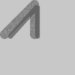
map bands overlay (canvas) (R: small road, G: circle, B: big road)
|
User Defined function that takes extra args
CREATE OR REPLACE FUNCTION raster_mapalgebra_userargs(
    rast1 double precision,
    rast2 double precision,
    pos integer[],
    VARIADIC userargs text[]
)
    RETURNS double precision
    AS $$
    DECLARE
    BEGIN
        CASE
            WHEN rast1 IS NOT NULL AND rast2 IS NOT NULL THEN
                RETURN least(userargs[1]::integer,(rast1 + rast2)/2.);
            WHEN rast1 IS NULL AND rast2 IS NULL THEN
                RETURN userargs[2]::integer;
            WHEN rast1 IS NULL THEN
                RETURN greatest(rast2,random()*userargs[3]::integer)::integer;
            ELSE
                RETURN greatest(rast1, random()*userargs[4]::integer)::integer;
        END CASE;

        RETURN NULL;
    END;
    $$ LANGUAGE 'plpgsql' VOLATILE COST 1000;

SELECT ST_MapAlgebraFct(m1.rast, 1, m1.rast, 3,
            'raster_mapalgebra_userargs(double precision, double precision, integer[], text[])'::regprocedure,
                '8BUI', 'INTERSECT', '100','200','200','0')
                FROM map_shapes As m1
    WHERE m1.descrip = 'map bands overlay fct union (canvas)';

user defined with extra args and different bands from same raster
See Also
ST_MapAlgebraExpr , ST_BandPixelType , ST_GeoReference , ST_SetValue